Home » Clark Fork Info » History » 1980s: Cleanup Begins

The Environmental Legacy of Over a Century of Industrial Mining

In the mid-1980s, the Clark Fork Basin environment was far from healthy. In the urban center of Uptown Butte, abandoned mine dumps still covered the hill, in between houses and businesses, and with little to no natural vegetation present. Just downstream, Silver Bow Creek, after 100 years as an industrial sewer, was a toxic stream with little to no aquatic life due to metals contamination from mine waste in the streambanks, in the floodplain, and carried by surface runoff from mine dumps on the Butte hill. Further downstream in Anaconda, hundreds of millions of cubic yards of smelter tailings still remained. Near Deer Lodge, considerable volumes of mine waste in the Clark Fork River floodplain were easily distinguished by the lack of vegetation, and, in some places, streamside tailings deposits from the 1908 flood can erode into the river, causing sporadic fish kills. At the Milltown Dam, several million cubic yards of Butte and Anaconda tailings remained, buried in the reservoir, seeping into groundwater. In other words, the Clark Fork Basin in the mid-1980s was something of a mess.
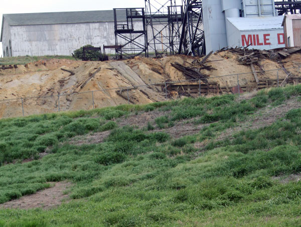
One of many abandoned mine dumps on the Butte Hill. This dump sits at the Mt. Con mine, famous for being "a mile deep." As part of the reclamation and restoration of the Upper Clark Fork Basin, many dumps have been capped with 18 inches of clean topsoil and revegetated to hold the waste in place, preventing it from eroding back into Silver Bow Creek, seeping into groundwater, or blowing away in high winds.
One of many abandoned mine dumps on the Butte Hill. This dump sits at the Mt. Con mine, famous for being “a mile deep.” As part of the reclamation and restoration of the Upper Clark Fork Basin, many dumps have been capped with 18 inches of clean topsoil and revegetated to hold the waste in place, preventing it from eroding back into Silver Bow Creek, seeping into groundwater, or blowing away in high winds.
Historic mine tailings deposits washed down Silver Bow Creek and settled in the floodplain and along streambanks, hindering vegetation and harming aquatic life. This stretch of the creek, where it meets Browns Gulch, has already been restored. Tailings are removed to the BP-Arco Waste Repository, the stream channel and banks are reconstructed with new, clean soil, and the floodplain and banks have been revegetated. Restoration work still continues downstream of this site.
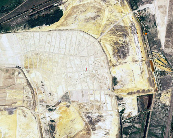
The Opportunity Ponds, now called the BP-Arco Waste Repository, historically served as one of the main mine tailings disposal areas for the Anaconda smelter. The site covers roughly five square miles, and holds over 160 million cubic yards of mine tailings. In some parts of the complex, tailings are 40 feet thick. Historically, the tailings were mixed with water, but with the end of smelting, they were left to dry out, leading to dust storms that could potentially impact human health. As part of the reclamation and restoration of the Upper Clark Fork Basin, tailings have been capped with cleaner topsoil. The area is then revegetated; vegetation prevents erosion and holds the waste in place, reducing potential impacts from dust storms.
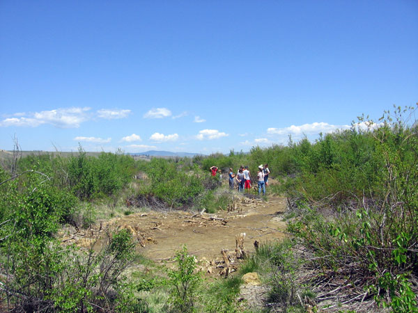
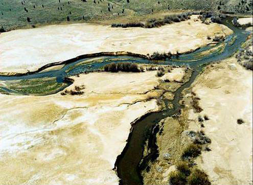
Tailings deposits are still found as far downstream as the Deer Lodge area. Locally known as "slickens", tailings-contaminated areas in the Clark Fork River floodplain are easily identifiable due to lack of vegetation. The reclamation and restoration of tailings-contaminated areas of the Deer Lodge Valley are currently underway.
Tailings deposits are still found as far downstream as the Deer Lodge area. Locally known as “slickens”, tailings-contaminated areas in the Clark Fork River floodplain are easily identifiable due to lack of vegetation. The reclamation and restoration of tailings-contaminated areas of the Deer Lodge Valley are currently underway.
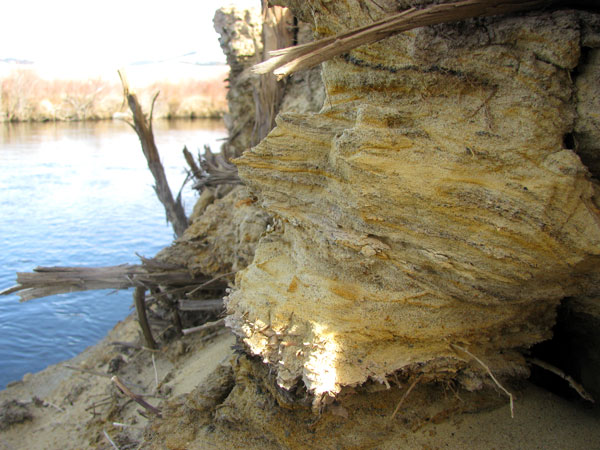
Tailings deposits still contaminate some streambanks along the Clark Fork River near Deer Lodge. The reclamation and restoration of tailings-contaminated areas of the Deer Lodge Valley are currently underway.
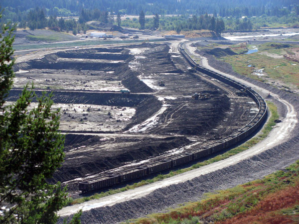
Mine tailings washed downstream in a massive 1908 flood and settled in the Milltown Reservoir near Missoula. Arsenic from the tailings had seeped into the groundwater supply for the nearby communities of Bonner and Milltown by the 1980s. As part of the reclamation and restoration of the Upper Clark Fork Basin, the Milltown Dam was removed, tailings deposits were shipped by rail to the BP-Arco Waste Repository, and the area is being restored.

1980: Superfund

In 1980, the U.S. Congress passed the Comprehensive Environmental Response, Compensation, and Liability Act, also known as CERCLA, or, more commonly, Superfund. Combined with the Clean Air Act of 1970 and the Clean Water Act of 1972, Superfund provided the impetus for the beginning of cleanup in the Clark Fork. But actual on-the-ground remediation and restoration were still a decade or two away. Starting in the mid-1980s, sites around the basic were gradually added to the Superfund National Priorities List. The EPA began to negotiate the details of remediation with the State of Montana, local communities, and the Potentially Responsible Parties (PRPs), the formal term for the business entities liable for cleanup costs. In the case of the Clark Fork, BP-ARCO, who purchased the old Anaconda Company in 1977, is the main PRP, although there are others. Concurrently, the State of Montana filed a lawsuit against ARCO to cover costs for restoration, going beyond EPA-mandated reclamation. A portion of the lawsuit was settled in 1998, and $85 million was allocated for the restoration of Silver Bow Creek. Settlements soon followed for other sites, such as the Milltown Dam, although settlements for other sites in the basin are still being negotiated.

For more information on Clark Fork Basin Superfund sites and ongoing reclamation and restoration, visit the EPA Montana Superfund page, the Montana Department of Environmental Quality Clark Fork River site, and the Montana Department of Environmental Quality Silver Bow Creek site.

Click here to return to the main History page
Click here to continue to The Present: Working for a Healthy Clark Fork Basin

Leave a Reply